Ordnance Survey
In stock
RRP:16.99
Your price:
£15.29
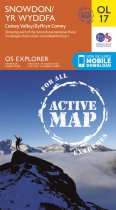
OS Explorer is the Ordnance Survey's most detailed map and is recommended for anyone...
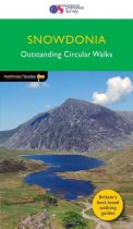
Discover Snowdonia with this Outstanding Circular Walks guide book. Pathfinder have...
Discover more of the great outdoors with Navigation Skills for Walkers and Pathfinder...
For use whether touring or exploring, these maps show the road network as well as...
Jarrold Pathfinder Guides are the ideal companion for country walks throughout the...
A laminated all purpose map packed full of information to help you really get to know...
An all purpose map packed full of information to help you really get to know an area....
An all purpose map packed full of information to help you really get to know an area....
An all purpose map packed full of information to help you really get to know an area....
An all purpose map packed full of information to help you really get to know an area....
Every part of England, Scotland and Wales - however remote - is covered by 403 maps...
Every part of England, Scotland and Wales - however remote - is covered by 403 maps...

