Scottish Cycle
Items 1 to 32 of 33 total
This area map shows the National Cycle Network and local routes in this area. It covers the Aberdeenshire region in Scotland including: Aberdeen, Banff, Buckie and Stonehaven.
...
In Stock
This area map shows the National Cycle Network and local routes in this area. It covers Ayrshire region in Scotland including: Paisley, Kilwinning, Hamilton, Irvine, Ayr, Kilmarnock...
In Stock
This area map shows the National Cycle Network and local routes in this area. It covers The Cairngorms National Park and the Moray Coast region in Scotland, including Pitlochry...
In Stock
This linear map shows the route and immediate surrounding area over a series of separate map panels.
The map covers the stunning northern half of the Coast and Castles cycle...
In Stock
Explore some of Perthshire's less frequented roads with stunning views of the surrounding hills. 1:180,000 scale.
In Stock
Explore some of Perthshire's less frequented roads with stunning views of the surrounding hills.
In Stock
This area map shows the National Cycle Network and local routes in this area. It covers Dundee, Angus & North Fife region in Scotland including: Perth, Glenrothe, St Andrews, Dundee...
In Stock
Full-colour double-sided route planner map covering East Lothian at 1:30,000, with 1:10,000 street maps of North Berwick, Haddington, Dunbar, Tranent, Musselburgh, Wallyford on...
In Stock
This is in the series of official pocket sized, folded maps to the National Cycle Network which include clearly mapped on-road and traffic-free paths, easy to read contours and...
In Stock
The Scottish Borders Cycle Tour
In Stock
Cycle map/guide to five easy-to-follow rides
In Stock
Cycle map/guide to six easy-to-follow rides.
In Stock
This is in the series of official pocket sized, folded maps to the National Cycle Network which include clearly mapped on-road and traffic-free paths, easy to read contours and...
In Stock
This area map shows the National Cycle Network and local routes in this area. It covers the Great Glen & Loch Ness region in Scotland including: Inverness, Fort William and Dingwall...
In Stock
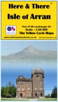
Here and There maps bring local mapping to a wider audience. They are very popular with local people but are also ideally suited to visitors looking to take a cycle or walk in...
In Stock
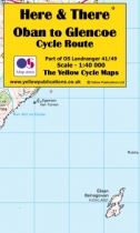
Here and There maps bring local mapping to a wider audience. They are very popular with local people but are also ideally suited to visitors looking to take a cycle or walk in...
In Stock
Here and There maps bring local mapping to a wider audience. They are very popular with local people but are also ideally suited to visitors looking to take a cycle or walk in...
In Stock
Here and There maps bring local mapping to a wider audience. They are very popular with local people but are also ideally suited to visitors looking to take a cycle or walk in...
In Stock
Here and There maps bring local mapping to a wider audience. They are very popular with local people but are also ideally suited to visitors looking to take a cycle or walk in...
In Stock
Here and There maps bring local mapping to a wider audience. They are very popular with local people but are also ideally suited to visitors looking to take a cycle or walk in...
In Stock
Here and There maps bring local mapping to a wider audience. They are very popular with local people but are also ideally suited to visitors looking to take a cycle or walk in...
In Stock
This area map shows the National Cycle Network and local routes in this area. It covers the north-eastern most region in Scotland, including Tain, Lairg, Thurso and Wick.
This...
In Stock
This area map shows the Lochs & Glens North cycle route and surrounding area over a series of separate map panels.
Lochs & Glens North from Glasgow to Inverness is a beautiful...
In Stock
This area map shows the Lochs & Glens South cycle route and surrounding area over a series of map panels.
The map covers the southern half of the Lochs & Glens route, from Carlisle...
In Stock
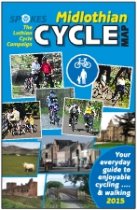
Full-colour map of the Midlothian region south of Edinburgh. Double-sided map shows routeplanner for the whole area at 1:30,000, highlighting quiet roads and places of interest...
In Stock
This is in the series of official pocket sized, folded maps to the National Cycle Network which include clearly mapped on-road and traffic-free paths, easy to read contours and...
In Stock
This map covers National Route 78 from Oban to Inverness passing through Fort William, Fort Augustus and along the shore of Loch Ness. We recommend taking at least three days to...
In Stock
This area map shows the National Cycle Network and local routes in this area. It covers Oban and Kintyre Peninsular region in Scotland including: Oban, Lochgilphead, Campbeltown...
In Stock
This area map shows the National Cycle Network and local routes in this area. It covers Perth and Kinross region in Scotland, including Dunblane, Callander, Killin, Bridge of Allen...
In Stock
This map shows the Salmon Run route and surrounding area.
The Salmon Run follows the 54 miles of National Route 77 as it follows the winding course of the River Tay between...
In Stock
This area map shows the National Cycle Network and local routes in this area. It covers Dumfries and Galloway region in Scotland including: Dumfries, Castle Douglas, Kirkcudbright...
In Stock
Full-colour double-sided route planner map covering West Lothian at 1:30,000, with a 1:10,000 street map of Livingston.
Shows off-road routes (all gradients marked), rail access...
In Stock
Items 1 to 32 of 33 total